GIS Enabled Construction Inspection Software
Building out your digital infrastructure starts with capturing precise, geo-located construction project data during the inspection process. We’ve partnered with industry-leading geospatial companies to provide combined solutions that boost efficiency today while laying the groundwork for future asset lifecycle management.
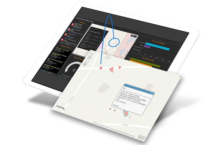
Our solutions combine construction administration and inspection data with easily shareable maps and dashboards to improve transparency, collaboration, and reporting on every project.
The Value of GIS-Enabled Construction Inspection Data
Location, location, location isn’t just the motto for real estate agents anymore. Construction teams are realizing the benefits of connecting geo-location data to their pay items on projects, and the role it plays in the growing demand for full digital project delivery and asset lifecycle management.
When your geo-located construction project data is integrated with details from inspection reports, it allows teams to create comprehensive digital-as builts that support more efficient management of infrastructure assets across their full lifecycle. Other benefits include:
-
Increased efficiency in the field with automated inspection workflows
-
Meeting growing demand from clients for digital infrastructure data
-
Raising the bar to require data in a digital format with precise locations
-
Providing asset management programs with necessary digital content
Create the Ideal GIS-Enabled Construction Inspection Environment
We work with state/local agencies and AEC firms to build digital inspection environments powered by GIS. Whether that means leveraging your existing tools or integrating new technology, we’ll find a solution that works for your organization’s unique needs and goals. The centerpiece of our GIS-enabled construction inspection solutions is Appia®, a cloud-based hub for construction contract and inspection that integrates with leading GIS platforms and data collectors.
Our Integrated Solutions

Automated Construction Data Visualization Extension
Appia + Esri ArcGIS Field Maps Integration

Our GIS Solution Providers
Want to take a hands-on look at our GIS-enabled inspection solutions? We’ve partnered with some of the most experienced geospatial companies in the industry to offer bundled software and hardware solutions. Learn more about our distributors below.

Seiler Geospatial
Duncan-Parnell

Contact Us
Ready to learn more about GIS-enabled construction inspection? Fill out the form and we’ll be in touch.